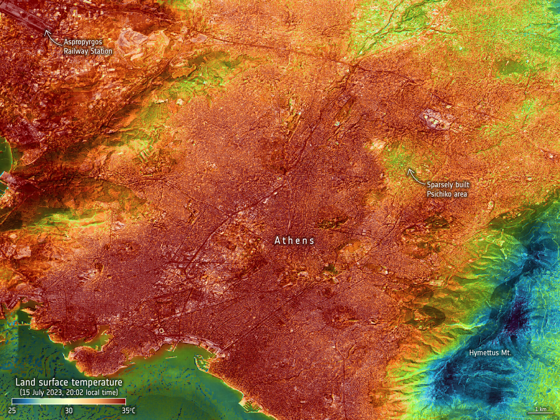
Monitoring Urban Nighttime Heat from Space
In July 2023, the world experienced the hottest month on record, according to the World Meteorological Organization. The impact of climate change is becoming more severe and happening sooner than expected, with rising global temperatures causing damage to the natural world and its inhabitants. One of the most concerning effects of extreme temperatures is the direct impact on the human body.
A recent study published in Nature Medicine estimated that over 60,000 heat-related deaths occurred in Europe between May and September 2022. This serves as proof that extreme temperatures are breaking records and posing a significant threat to human health. With 56% of the world’s population living in cities, the issue becomes even more critical. The urban heat island effect exacerbates the dangers of heatwaves in urban areas.
Urban heat islands occur when natural land cover, such as vegetation, is replaced by buildings, roads, and pavements that absorb and re-emit heat from the sun. As a result, urban areas become ‘islands’ of higher temperatures compared to surrounding rural areas. This temperature difference is more pronounced at night.
To understand and monitor urban heat islands, measurements of land-surface temperature are crucial. Land-surface temperature differs from air temperature, which is commonly used in weather forecasts. Air temperature measures how hot the air is around 1 meter above the ground, while land-surface temperature measures how hot the actual surface would feel to the touch. During heatwaves, the surface tends to be hotter than the air.
NASA’s Ecostress instrument, located on the International Space Station, has captured images of land-surface temperatures in cities such as Athens, Rome, and Vienna. These images offer a glimpse of what will be delivered operationally by the upcoming Land Surface Temperature Monitoring (LSTM) mission, an expansion satellite of the Copernicus Sentinel program.
The LSTM mission, a joint effort between NASA and ESA, promises to be a game-changer for urban planners. By providing high-resolution measurements of land-surface temperatures, LSTM will help inform decisions to mitigate the impacts of heatwaves. Planners will be able to determine where to plant shading trees, use cooling coatings for pavements and roofs, and implement other strategies to combat the urban heat island effect.
ESA’s Green Transition Information Factory is an online platform that uses Earth observation data to accelerate the green transition for society and the economy. Users can explore land surface temperatures across Austria and map the presence of green roofs on buildings. Green roofs are effective in mitigating the urban heat island effect by increasing evapotranspiration of plants, reducing energy consumption, and sequestering carbon.
The platform’s ability to map green roofs provides valuable insights into their impact on mitigating the urban heat island effect. This information helps cities plan further mitigation measures and prepare for extreme heatwaves in the future. The Green Transition Information Factory is also preparing for the Space for Green Future Accelerator, an initiative driving innovation and the use of space technology in addressing the global climate crisis.
As the impacts of climate change intensify, tracking land-surface temperature becomes increasingly important. With the LSTM mission and platforms like the Green Transition Information Factory, urban planners have access to valuable tools to combat the urban heat island effect and protect city dwellers from extreme temperatures. By utilizing space technology and Earth observation data, we can better understand and prepare for the challenges posed by climate change.
